
In the news
New Lake District Drone Technology assists with a difficult find in the Scottish highlands
October 31, 2023
A walker who had been missing for six weeks in the Scottish highlands has been found, with the help of new Mountain Rescue drone technology.
On the 7th September 2023, Police Scotland received a call to report a hillwalker who had not returned after a planned trip in the Glencoe area of the Scottish Highlands. The police mobilised the nearby Glencoe Mountain Rescue Team (MRT) and a fullscale search operation launched in earnest.
What followed was a herculean effort, involving multiple MRTs, Coastguard helicopters, RAF MRTs, search dogs, drones and police cell data analysis. In spite of the exhaustive efforts from all involved, and some encouraging signs (such as the finding of the missing persons rucksack), Glencoe MRT made the difficult decision to scale back their operations after ten days of effort. However, the mountain rescue team did not stop searching, with various MRT members going out on most free days, but the complexity of the ground and size of the area made work difficult for them.
During the latter stages of the operation, Glencoe MRT were approached by members of the Lake District Search and Mountain Rescue Association (LDSAMRA) drone group, who have been developing some new, computer assisted search software for drones.
They were looking for an opportunity to test their latest software, and offered to assist the search efforts. Members of the LDSAMRA drone group met with a representative from Glencoe MRT, who briefed them on the extensive efforts conducted by their team, and theories they had developed.
Some time passed whilst waiting for a weather window, but eventually a team from the LDSAMRA, which comprised of members of both Cockermouth MRT and Duddon and Furness MRT made their way to Glencoe. Several theories were mooted, and the night before deployment plans were drawn using bespoke software that programs a flight path into a drone. The team of three were to split up and each search opposite faces in the valley where the missing persons rucksack had been found. The ground had already been covered multiple times on foot, and overflown by helicopters, but was so broken and complex it remained the most likely location.
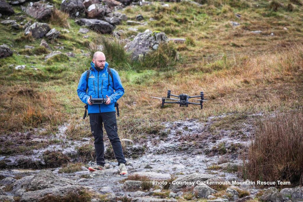
On the morning of the 24 October, the team deployed accompanied by a member of Glencoe MRT. The team split up, as planned, and began searching their respective areas. The software autonomously covers an area with a drone, taking multiple photographs as it goes. Each photo is overlapped, so objects that cannot be seen from one angle, can be spotted from another. After the drone lands, those photos are analysed by the software, which searches each image for unusually coloured clusters of pixels, i.e. things that don’t belong in the natural landscape. These anomalies are then viewed by the team on the hill, so they can determine if any require further investigation. Further analysis can then be conducted later, off the hill, to ensure a high degree of confidence in the areas searched.
Later that morning, one of the two drone search teams reported a potential find in their area and the other team diverted their drone to the location of the anomaly and were able to confirm the casualty find. Glencoe MRT and the police were quickly informed while the hill team made their way to the location of the casualty, and were joined by the rest of Glencoe MRT who conducted a very swift and professional evacuation. The LDSAMRA drone teams join Glencoe MRT and all other agencies in offering their condolences to the missing walker’s family.
Postscript
This new technology has brought drone searching forward leaps and bounds, and while this find was a huge milestone for development, it would not have been possible without the incredible groundwork carried out by Glencoe MRT and all the other agencies involved. The area of the find in question had been searched by ground teams, at least twice, all passing within 50 meters of the body. It had also been overflown with helicopters and dogs had searched nearby. The complexity of the ground meant that despite these efforts, the body remained hidden. In extremely broken steep ground, objects can be obscured from line of sight by those on foot from as little as a couple of meters away. This is a milestone case study in the future of drone use in Mountain Rescue. The hope is that this new technology can go on to save lives at risk, and bring answers and closure to the families of those whose time has passed.